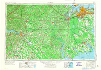
1953 Map of Norfolk
USGS Topo · Published 1973About this map
The Dismal Swamp dominates the coastal landscape of the Tidewater region and northeastern North Carolina, serving as a massive natural boundary between the urban centers of Norfolk and Portsmouth and the rural agricultural tracts to the south. This mid-century survey illustrates a complex network of waterways and rail lines that sustained the regional economy, from the Chowan River and Albemarle Sound to the heavy rail corridors of the Norfolk Southern Ry and Seaboard Air Line RR. In the west, the emergence of Lake Gaston on the Roanoke River reflects mid-century infrastructure shifts, while the coast remains anchored by major defense installations like the Norfolk Naval Base and Oceana Naval Air Station. Small river towns such as Edenton, Elizabeth City, and Franklin appear as vital hubs within a landscape defined by blackwater creeks and timbered wetlands.
Find a feature on this map
234 named features on this map. Tap any name to fly to it.
Don’t see what you’re looking for? This feature index may not catch every label — zoom into the map to look around manually.
Map Details
Editions of this 1953 Norfolk Map
4 editions found

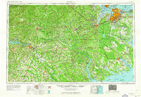
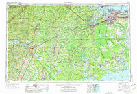
Other maps of this area

1891 · Farmville
USGS Topo · 1:125,000

1893 · Farmville
USGS Topo · 1:125,000

1893 · Virginia Beach
USGS Topo · 1:125,000

1894 · Petersburg
USGS Topo · 1:62,500

1897 · Amelia
USGS Topo · 1:125,000

1901 · Parmele
USGS Topo · 1:62,500

1901 · Williamston
USGS Topo · 1:62,500

1902 · Williamston
USGS Topo · 1:62,500

1902 · Parmele
USGS Topo · 1:62,500

1902 · Rocky Mount
USGS Topo · 1:62,500