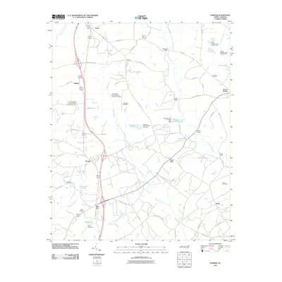
2010 Map of Norman
USGS Topo · Published 2010About this map
Norman and the surrounding rural communities of Richmond and Moore Counties are defined by a network of creeks and small family-named ponds that characterize the region's agricultural and industrial heritage. The landscape is bisected by Naked Creek and Drowning Creek, where historical crossings like McKenzie Bridge, Stewart Bridge, and Harris Bridge linked isolated settlements. Local genealogy is well-represented through numerous burial grounds, including Pleasant Hill Cemetery, Belford Cemetery, and the Williamson Cemetery near Haywoods Ponds. To the east, the community of Jackson Springs sits near a collection of water features such as Curries Pond and McCaskill Pond. The map also captures smaller locales like Wind Blow, Rubyatt, and Emery, showing a pattern of dispersed homesteads and rural routes like Belford Church Rd that connect these long-established North Carolina neighborhoods.
Find a feature on this map
81 named features on this map. Tap any name to fly to it.
Don’t see what you’re looking for? This feature index may not catch every label — zoom into the map to look around manually.
Map Details
Editions of this 2010 Norman Map
This is the sole edition of this map. No revisions or reprints were ever made.
Other maps of this area

1942 · Troy
USGS Topo · 1:125,000

1949 · Millstone Lake
USGS Topo · 1:24,000

1949 · West End
USGS Topo · 1:24,000

1949 · Hoffman
USGS Topo · 1:24,000

1949 · Jackson Springs
USGS Topo · 1:62,500

1950 · Norman
USGS Topo · 1:24,000

1953 · Raleigh
USGS Topo · 1:250,000

1954 · Raleigh
USGS Topo · 1:250,000

1956 · Ellerbe
USGS Topo · 1:24,000

1956 · Harrisville
USGS Topo · 1:24,000