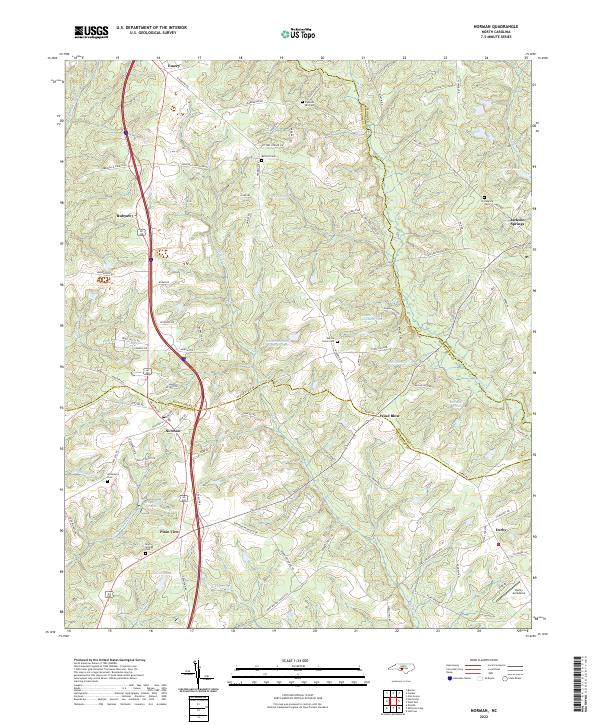
2022 Map of Norman
USGS Topo · Published 2022About this map
Norman serves as the focal point of this Piedmont landscape where Moore, Montgomery, and Richmond counties meet. The terrain is defined by a dense network of tributaries including Naked Cr and Drowning Cr, alongside man-made water bodies such as Research Pond Number One and McCaskill Pond. The settlement pattern reflects long-established rural communities, connected by a web of historic thoroughfares like Windblow Rd and Tabernacle Church Rd.
Find a feature on this map
98 named features on this map. Tap any name to fly to it.
Don’t see what you’re looking for? This feature index may not catch every label — zoom into the map to look around manually.
Map Details
Editions of this 2022 Norman Map
This is the sole edition of this map. No revisions or reprints were ever made.
Other maps of this area

1942 · Troy
USGS Topo · 1:125,000

1949 · Millstone Lake
USGS Topo · 1:24,000

1949 · West End
USGS Topo · 1:24,000

1949 · Hoffman
USGS Topo · 1:24,000

1949 · Jackson Springs
USGS Topo · 1:62,500

1950 · Norman
USGS Topo · 1:24,000

1953 · Raleigh
USGS Topo · 1:250,000

1954 · Raleigh
USGS Topo · 1:250,000

1956 · Ellerbe
USGS Topo · 1:24,000

1956 · Harrisville
USGS Topo · 1:24,000