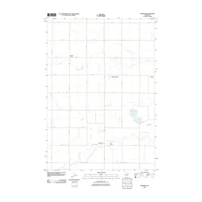
2010 Map of Normania
USGS Topo · Published 2010About this map
The Yellow Medicine River winds through the southern landscape of this agricultural region, providing a natural contrast to the rigid grid of rural roads. This 2010 survey of the Normania area highlights a pattern of settlement deeply tied to its heritage, as evidenced by several localized burial grounds serving the farming community. Genealogists may find particular interest in the Spring Creek Norwegian Lutheran Cemetery, Bethlehem Cemetery, and Saint Lucas Cemetery, which reflect the cultural history of the townships. The terrain is further defined by several water bodies, including the meandering path of Spring Creek in the north and the cluster of Spellman Lake and Miedd Lake to the east. The map detail illustrates the transition from the upland prairies to the river valley, where roads like County Hwy-D1 and Lyon Yellow Medicine Rd follow the local topography.
Find a feature on this map
24 named features on this map. Tap any name to fly to it.
Don’t see what you’re looking for? This feature index may not catch every label — zoom into the map to look around manually.
Map Details
Editions of this 2010 Normania Map
This is the sole edition of this map. No revisions or reprints were ever made.
Other maps of this area

1953 · New Ulm
USGS Topo · 1:250,000

1957 · New Ulm
USGS Topo · 1:250,000

1958 · New Ulm
USGS Topo · 1:250,000

1962 · Wood Lake NW
USGS Topo · 1:24,000

1962 · Cottonwood
USGS Topo · 1:24,000

1965 · Clarkfield
USGS Topo · 1:24,000

1965 · Hazel Run
USGS Topo · 1:24,000

1965 · Boyd
USGS Topo · 1:24,000

1967 · New Ulm
USGS Topo · 1:250,000

1967 · Minneota
USGS Topo · 1:24,000