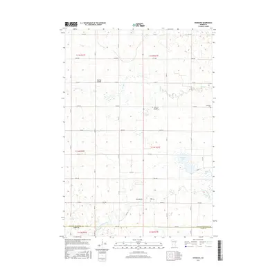
2016 Map of Normania
USGS Topo · Published 2016About this map
Normania sits at the heart of this agricultural landscape in Yellow Medicine County, where the plains are defined by a network of drainage and prairie water bodies. The Yellow Medicine River winds through the southern reaches of the township, while Spellman Lake and Miedd Lake occupy the eastern sections. This survey provides a precise look at the rural social geography of the area, anchored by several denominationally distinct burial grounds including the Spring Creek Norwegian Lutheran Cem, Saint Lucas Cem, and Bethlehem Cem. The township's rectilinear road grid, composed of thoroughfares like Co Hwy 3 and 170th Ave, organizes the prairie into a pattern of farmsteads and fields characteristic of the Upper Midwest. Minor waterways like Spring Creek cut across these sections, revealing the subtle topography that influenced early settlement and cemetery placement on higher ground.
Find a feature on this map
32 named features on this map. Tap any name to fly to it.
Don’t see what you’re looking for? This feature index may not catch every label — zoom into the map to look around manually.
Map Details
Editions of this 2016 Normania Map
This is the sole edition of this map. No revisions or reprints were ever made.
Other maps of this area

1953 · New Ulm
USGS Topo · 1:250,000

1957 · New Ulm
USGS Topo · 1:250,000

1958 · New Ulm
USGS Topo · 1:250,000

1962 · Wood Lake NW
USGS Topo · 1:24,000

1962 · Cottonwood
USGS Topo · 1:24,000

1965 · Clarkfield
USGS Topo · 1:24,000

1965 · Hazel Run
USGS Topo · 1:24,000

1965 · Boyd
USGS Topo · 1:24,000

1967 · New Ulm
USGS Topo · 1:250,000

1967 · Minneota
USGS Topo · 1:24,000