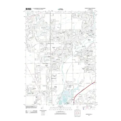
2012 Map of Normantown
USGS Topo · Published 2012About this map
Zion Lutheran Church Cem and the Vermont Cem anchor the suburban landscape of this 2012 survey, which covers a rapidly developing corridor in northeastern Illinois. This era is defined by the dense clustering of residential subdivisions like Heatherstone, High Meadow, and Indian Boundary, where modern street grids have replaced former agricultural lands. The DuPage River and its tributaries, including Spring Brook and Lily Cache Cr, serve as the primary natural drainage for the region, with Wolf Creek Island standing out as a distinct terrain feature. Transport and recreation are central to the area's layout, highlighted by the presence of Bolingbrook's Clow International Airport and Day Airport, alongside numerous greenspaces such as the White Eagle Golf Course and Spring Brook Golf Course. The map captures the suburban transition, where historical sites like the Wheatland Cem remain amidst a network of major thoroughfares like W 111th St.
Find a feature on this map
81 named features on this map. Tap any name to fly to it.
Don’t see what you’re looking for? This feature index may not catch every label — zoom into the map to look around manually.
Map Details
Editions of this 2012 Normantown Map
This is the sole edition of this map. No revisions or reprints were ever made.
Other maps of this area

1892 · Joliet
USGS Topo · 1:62,500

1908 · Wheaton
USGS Topo · 1:62,500

1923 · Joliet
USGS Topo · 1:62,500

1925 · Yorkville
USGS Topo · 1:62,500

1932 · Geneva
USGS Topo · 1:62,500

1948 · Wheaton
USGS Topo · 1:62,500

1948 · Geneva
USGS Topo · 1:62,500

1950 · Aurora North
USGS Topo · 1:24,000

1953 · Naperville
USGS Topo · 1:24,000

1953 · Yorkville SE
USGS Topo · 1:24,000