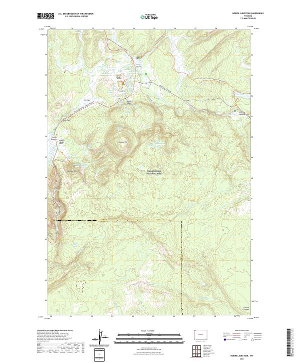
2021 Map of Norris Junction
USGS Topo · Published 2021About this map
Norris Geyser Basin serves as the focal point of this geothermal landscape, revealing a dense concentration of thermal features including the famous Steamboat Geyser, Echinus Geyser, and the Minute Geyser. The hydrology of the area is dominated by the Gibbon River, which flows through Gibbon Meadows and down into Gibbon Canyon. This modern survey details the intricate network of roads and trails connecting these landmarks, such as the Grand Loop Road and the Artists Paintpots Trl.
Find a feature on this map
72 named features on this map. Tap any name to fly to it.
Don’t see what you’re looking for? This feature index may not catch every label — zoom into the map to look around manually.
Map Details
Editions of this 2021 Norris Junction Map
This is the sole edition of this map. No revisions or reprints were ever made.
Other maps of this area

1885 · Gallatin
USGS Topo · 1:125,000

1885 · Gallatin
USGS Topo · 1:125,000

1901 · Gallatin
USGS Topo · 1:125,000

1908 · Gallatin
USGS Topo · 1:125,000

1911 · Gallatin
USGS Topo · 1:125,000

1955 · Ashton
USGS Topo · 1:250,000

1958 · Ashton
USGS Topo · 1:250,000

1958 · Madison Junction
USGS Topo · 1:62,500

1958 · Mount Holmes
USGS Topo · 1:62,500
1958 · Norris Junction
USGS Topo · 1:62,500