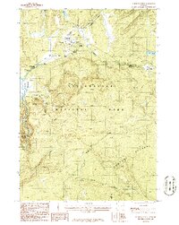
1986 Map of Norris Junction
USGS Topo · Published 1986About this map
Norris Geyser Basin serves as the thermal centerpiece of this mid-1980s topographic study within Yellowstone National Park. The landscape is defined by its active geothermal features, ranging from the Echinus Geyser to the multi-hued Artists Paintpots and the unique iron-rich formations at Chocolate Pots. This era of mapping documents the complex drainage systems of the Gibbon River and Solfatara Creek before significant modern infrastructure changes.
Find a feature on this map
36 named features on this map. Tap any name to fly to it.
Don’t see what you’re looking for? This feature index may not catch every label — zoom into the map to look around manually.
Map Details
Editions of this 1986 Norris Junction Map
This is the sole edition of this map. No revisions or reprints were ever made.
Other maps of this area

1885 · Gallatin
USGS Topo · 1:125,000

1885 · Gallatin
USGS Topo · 1:125,000

1901 · Gallatin
USGS Topo · 1:125,000

1908 · Gallatin
USGS Topo · 1:125,000

1911 · Gallatin
USGS Topo · 1:125,000

1955 · Ashton
USGS Topo · 1:250,000

1958 · Ashton
USGS Topo · 1:250,000

1958 · Madison Junction
USGS Topo · 1:62,500

1958 · Mount Holmes
USGS Topo · 1:62,500
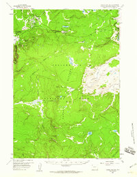
1958 · Norris Junction
USGS Topo · 1:62,500