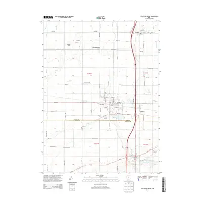
2013 Map of North Baltimore
USGS Topo · Published 2013About this map
The village of North Baltimore serves as the focal point of this Northwest Ohio landscape, situated at a major crossroads just north of the Wood Co Hancock Co line. The town's grid is dense with street labels and local landmarks like the Po and Briar Hill Golf Course, while the surrounding terrain is defined by the subtle elevations of Callahan Ridge and Howard Ridge. This area shows a persistent connection to the region's petroleum history with routes like Ohio Oil Rd and Oil Center Rd leading toward infrastructure such as Tank Siding and Tank Farm Rd near Cygnet.
Find a feature on this map
140 named features on this map. Tap any name to fly to it.
Don’t see what you’re looking for? This feature index may not catch every label — zoom into the map to look around manually.
Map Details
Editions of this 2013 North Baltimore Map
This is the sole edition of this map. No revisions or reprints were ever made.
Other maps of this area

1901 · Bowling Green
USGS Topo · 1:62,500

1903 · Bowling Green
USGS Topo · 1:62,500

1903 · Findlay
USGS Topo · 1:62,500

1909 · Mc Clure
USGS Topo · 1:62,500

1956 · Toledo
USGS Topo · 1:250,000

1958 · Jerry City
USGS Topo · 1:24,000

1958 · Bowling Green South
USGS Topo · 1:24,000

1960 · Bloomdale
USGS Topo · 1:24,000

1960 · North Baltimore
USGS Topo · 1:24,000
1960 · Weston
USGS Topo · 1:24,000