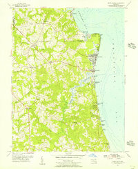
1953 Map of North Beach
USGS Topo · Published 1956About this map
Chesapeake Beach and North Beach stand as prominent coastal anchors along the western shore of the Chesapeake Bay in the mid-1950s. The landscape is defined by a series of specialized waterfront developments, ranging from the residential grids of Rose Haven and West Beach to the localized Willow Beach Colony and Holiday Beach. Inland, the terrain rises toward Owings Cliffs and Fairhaven Cliffs, giving way to a rural interior where established community hubs like Friendship, Paris, and Sunderland are situated along the ridgelines between tidal drainages. Significant historical markers include the U S Naval Reservation at Randle Cliff Beach and local spiritual centers such as All Saints Ch and St Edmonds Ch. The map also captures the recreational footprint of the era, notably at Camp Roosevelt and the Yacht Basin near Old Colony Cove.
Find a feature on this map
37 named features on this map. Tap any name to fly to it.
Don’t see what you’re looking for? This feature index may not catch every label — zoom into the map to look around manually.
Map Details
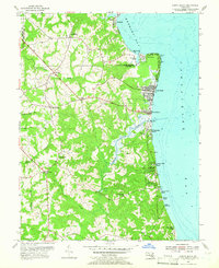
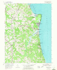
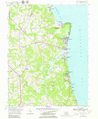
Editions of this 1953 North Beach Map
4 editions found
Other maps of this area

1892 · Prince Frederick
USGS Topo · 1:62,500

1892 · Owensville
USGS Topo · 1:62,500

1892 · Annapolis
USGS Topo · 1:62,500

1893 · Sharps Island
USGS Topo · 1:62,500

1895 · Prince Frederick
USGS Topo · 1:62,500

1895 · Owensville
USGS Topo · 1:62,500

1898 · Choptank
USGS Topo · 1:125,000

1899 · Patuxent
USGS Topo · 1:125,000

1901 · Prince Frederick
USGS Topo · 1:62,500

1904 · Annapolis
USGS Topo · 1:62,500