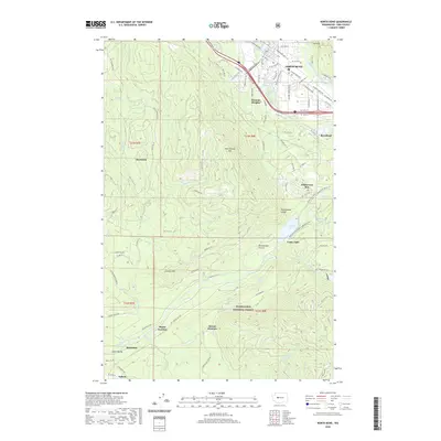
2020 Map of North Bend
USGS Topo · Published 2020About this map
North Bend and the surrounding river valleys are the focal points of this 2020 landscape, where the South Fork Snoqualmie River and Middle Fork Snoqualmie River converge near Harman Heights. This modern survey illustrates the transition from urbanized centers to the protected timberlands of the Snoqualmie National Forest. The map documents the repurposed infrastructure of the Pacific Northwest, specifically through the Palouse To Cascades State Park Trail and the Snoqualmie Valley Trail, which follow older transportation corridors. Notable smaller settlements and junctions such as Cedar Falls, Bagley Junction, and Snoose Junction are located south of the main city, situated near the headwaters of the Cedar River. The rugged topography is defined by prominent peaks like Rattlesnake Mountain and Lookout Mountain, while Rattlesnake Lake and Brewster Lake provide key water features within the watershed.
Find a feature on this map
69 named features on this map. Tap any name to fly to it.
Don’t see what you’re looking for? This feature index may not catch every label — zoom into the map to look around manually.
Map Details
Editions of this 2020 North Bend Map
This is the sole edition of this map. No revisions or reprints were ever made.
Other maps of this area

1913 · Cedar Lake
USGS Topo · 1:125,000

1921 · Sultan
USGS Topo · 1:125,000

1923 · Sultan
USGS Topo · 1:125,000

1953 · Snoqualmie
USGS Topo · 1:24,000

1953 · North Bend
USGS Topo · 1:24,000

1953 · Hobart
USGS Topo · 1:24,000

1953 · Fall City
USGS Topo · 1:24,000

1953 · Eagle Gorge
USGS Topo · 1:24,000

1953 · Cumberland
USGS Topo · 1:24,000

1957 · Wenatchee
USGS Topo · 1:250,000