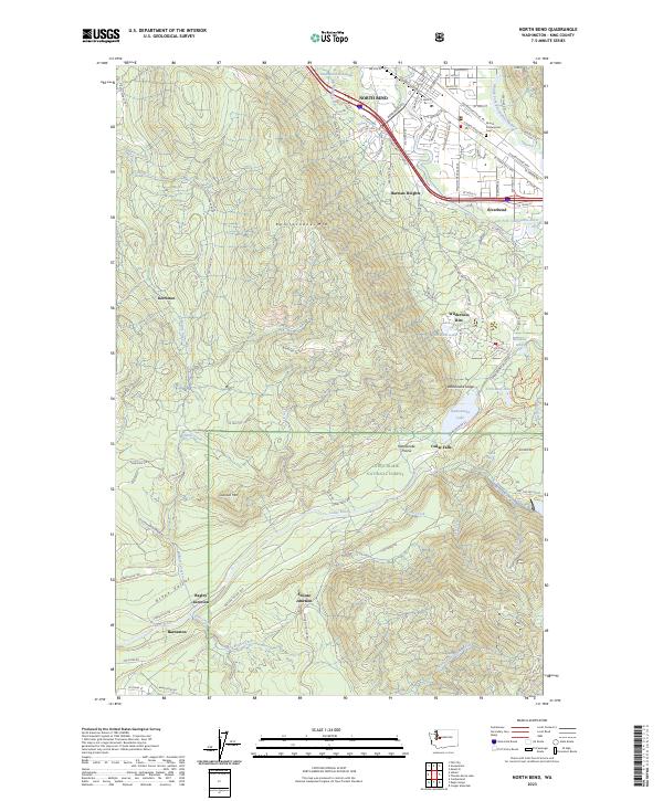
2023 Map of North Bend
USGS Topo · Published 2023About this map
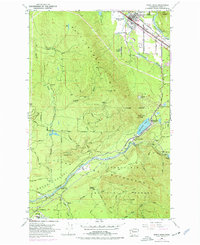
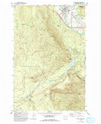
The South Fork Snoqualmie River flows through the northern reaches of this landscape, anchoring the valley floor near North Bend and its surrounding communities of Harman Heights and Riverbend. While the modern residential footprint is clear in the north, the map reveals a complex history of resource extraction and transit further south. Former logging and railway sites like Kerriston, Barneston, and the appropriately named Snoose Junction are found deep in the timbered slopes, connected by old grades and the Snoqualmie Valley Trl.
Find a feature on this map
94 named features on this map. Tap any name to fly to it.
Don’t see what you’re looking for? This feature index may not catch every label — zoom into the map to look around manually.
Map Details
Editions of this 2023 North Bend Map
This is the sole edition of this map. No revisions or reprints were ever made.
Historical Maps of Traverse Through Time
3 maps found