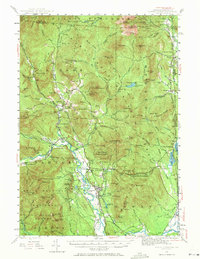
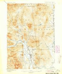
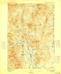
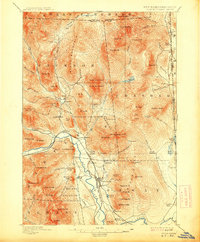
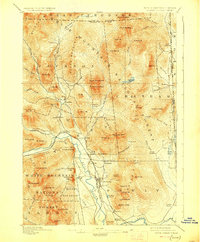
1896 Map of North Conway
USGS Topo · Published 1920About this map
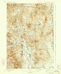
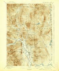
North Conway and the neighboring settlements of Lower Bartlett and Intervale form a dense corridor of development along the Saco River during the late 19th century. This area is defined by its early tourism and transit economy, evidenced by the convergence of the Boston and Maine R. R. and the Maine Central railroad lines. To the west, iconic landmarks like Cathedral Ledge and White Horse Ledge rise sharply above the valley floor, while to the north, the village of Jackson is surrounded by peaks including Thorn Mt. and Eagle Mt.. The map also details the remote eastern boundary where North Chatham and South Chatham sit along the Cold River, separated from the Conway valley by the formidable mass of Mt. Shaw and the Chatham range. Evidence of early industry appears at Redstone and near Goodrich Falls, highlighting the region's mix of natural spectacle and resource extraction.
Find a feature on this map
100 named features on this map. Tap any name to fly to it.
Don’t see what you’re looking for? This feature index may not catch every label — zoom into the map to look around manually.
Map Details
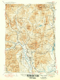
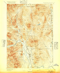
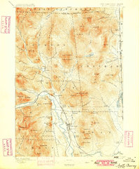
Editions of this 1896 North Conway Map
9 editions found

Historical Maps of Conway Through Time
4 maps found