
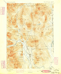
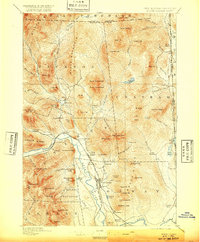
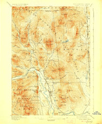
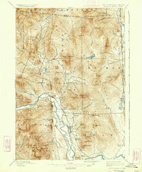
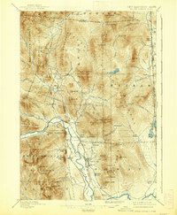
1896 Map of North Conway
USGS Topo · Published 1896About this map
The Saco River valley serves as the central artery for this 1890s survey, where the Maine Central and Boston and Maine R. R. converge near North Conway. This era of the White Mountains was defined by its transition from remote timber tracts to a premier destination for early travelers, anchored by established settlements like Jackson and Intervale. The map documents the intricate relationship between the sharp granite terrain and the industrial potential of the water, specifically at Goodrich Falls and the riverside works at Redstone.
Find a feature on this map
101 named features on this map. Tap any name to fly to it.
Don’t see what you’re looking for? This feature index may not catch every label — zoom into the map to look around manually.
Map Details
Editions of this 1896 North Conway Map
9 editions found
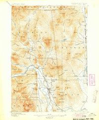
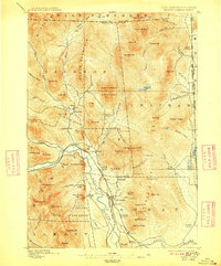
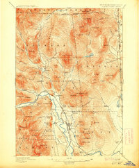
Other maps of this area

1893 · Mt. Washington
USGS Topo · 1:62,500

1893 · Gorham
USGS Topo · 1:62,500

1894 · North Conway
USGS Topo · 1:62,500

1895 · Crawford Notch
USGS Topo · 1:62,500

1896 · Mt. Washington
USGS Topo · 1:62,500

1896 · Crawford Notch
USGS Topo · 1:62,500

1896 · Gorham
USGS Topo · 1:62,500

1909 · Fryeburg
USGS Topo · 1:62,500

1910 · Kezar Falls
USGS Topo · 1:48,000

1911 · Fryeburg
USGS Topo · 1:62,500