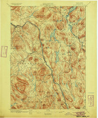
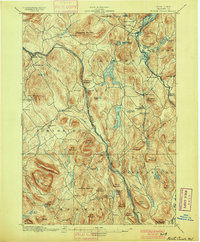
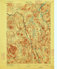
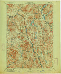
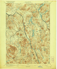
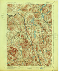
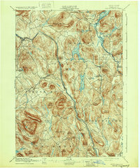
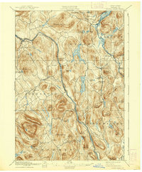
1897 Map of North Creek
USGS Topo · Published 1905About this map
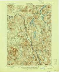
The Hudson River and Schroon River valleys anchor this late nineteenth-century study of Warren County, where the transition from river-based transport to rail is clearly visible. The Delaware and Hudson RR, noted as the Adirondack River line, terminates at North Creek, establishing the village as a vital hub for the region's logging and early tourism industries. This topography reveals a landscape dominated by peaks like Crane Mountain and Henderson Mountain, with settlements such as Chestertown, Johnsburg, and Pottersville clustered near the many ponds and lakes that define the terrain.
Find a feature on this map
76 named features on this map. Tap any name to fly to it.
Don’t see what you’re looking for? This feature index may not catch every label — zoom into the map to look around manually.
Map Details
Editions of this 1897 North Creek Map
10 editions found
Other maps of this area

1895 · North Creek
USGS Topo · 1:62,500

1895 · Paradox Lake
USGS Topo · 1:62,500

1895 · Glens Falls
USGS Topo · 1:62,500

1897 · Bolton
USGS Topo · 1:62,500

1897 · Glens Falls
USGS Topo · 1:62,500

1897 · Paradox Lake
USGS Topo · 1:62,500

1897 · North Creek
USGS Topo · 1:62,500

1897 · Schroon Lake
USGS Topo · 1:62,500

1898 · Newcomb
USGS Topo · 1:62,500

1898 · Thirteenth Lake
USGS Topo · 1:62,500