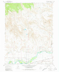
1962 Map of North Delta
USGS Topo · Published 1981About this map
The confluence of the Gunnison River and the Uncompahgre River shapes the development of this Colorado landscape, where irrigation infrastructure dominates the valley floor. A sophisticated network of water management, including the North Delta Canal, Hartland Ditch, and Bona Fide Ditch, supports the agricultural settlement of North Delta and the nearby Orchard City boundary. The Denver and Rio Grande Western railroad tracks parallel the river, marking the vital transportation corridor through the region in the early 1960s.
Find a feature on this map
39 named features on this map. Tap any name to fly to it.
Don’t see what you’re looking for? This feature index may not catch every label — zoom into the map to look around manually.
Map Details
Editions of this 1962 North Delta Map
3 editions found
Other maps of this area

1955 · Olathe NW
USGS Topo · 1:24,000

1956 · Montrose
USGS Topo · 1:250,000

1956 · Moab
USGS Topo · 1:250,000

1959 · Moab
USGS Topo · 1:250,000

1959 · Montrose
USGS Topo · 1:250,000

1960 · Montrose
USGS Topo · 1:250,000

1960 · Moab
USGS Topo · 1:250,000

1962 · Moab
USGS Topo · 1:250,000
1962 · North Delta
USGS Topo · 1:24,000
1962 · Orchard City
USGS Topo · 1:24,000