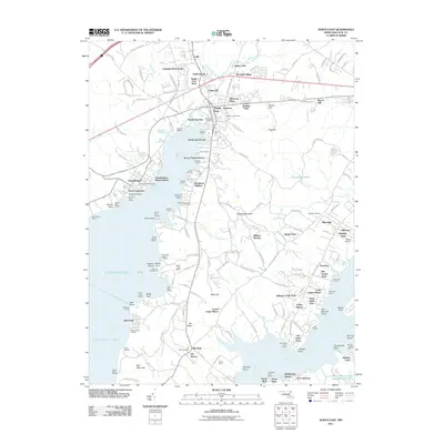
2011 Map of North East
USGS Topo · Published 2011About this map
The North East River dominates this portion of Cecil County, where the town of North East serves as a hub for both terrestrial and maritime activity. The landscape is characterized by its numerous fisheries, such as Frenchs Fishery and Beaver Dam Fishery, reflecting a long-standing coastal economy built around the Chesapeake Bay. Settlement patterns show a mix of established community centers like Charlestown and newer residential developments such as Villages of Elk Neck and Prestige Village. Historical roots are preserved in sites like Memorial Cemetery and the Elk Neck Cemetery further south. The CSX rail line and major thoroughfares like Bethel Church Rd cut across the northern terrain, connecting the shoreline settlements to the broader inland region, while landmarks like Bull Mountain provide distinctive topographic relief near the bay.
Find a feature on this map
168 named features on this map. Tap any name to fly to it.
Don’t see what you’re looking for? This feature index may not catch every label — zoom into the map to look around manually.
Map Details
Editions of this 2011 North East Map
This is the sole edition of this map. No revisions or reprints were ever made.
Other maps of this area

1898 · Elkton
USGS Topo · 1:62,500

1898 · Tolchester
USGS Topo · 1:125,000

1899 · Dover
USGS Topo · 1:125,000

1900 · Elkton
USGS Topo · 1:62,500

1900 · Cecilton
USGS Topo · 1:62,500

1900 · Havre De Grace
USGS Topo · 1:62,500

1900 · Betterton
USGS Topo · 1:62,500

1903 · Tolchester
USGS Topo · 1:125,000

1906 · Dover
USGS Topo · 1:125,000

1908 · Tolchester
USGS Topo · 1:125,000