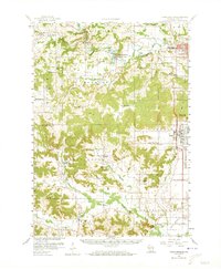
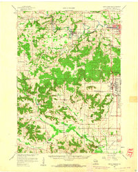
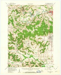
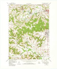
1958 Map of North Freedom
USGS Topo · Published 1973About this map
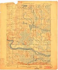
The Baraboo River winds through this 1958 landscape, providing a geographic anchor for the villages of North Freedom and Rock Springs. To the east, the extensive footprint of the Badger Ordnance Works stands in stark contrast to the rural character of the surrounding townships. The area is marked by a high density of local institutions, from country schools like Pewits Nest Sch and Elder Ridge Sch to significant cultural landmarks such as Free Thinkers Hall and the Mt Ida Convent.
Find a feature on this map
65 named features on this map. Tap any name to fly to it.
Don’t see what you’re looking for? This feature index may not catch every label — zoom into the map to look around manually.
Map Details
Editions of this 1958 North Freedom Map
4 editions found
Other maps of this area

1895 · Baraboo
USGS Topo · 1:62,500

1901 · Denzer
USGS Topo · 1:62,500

1901 · The Dells
USGS Topo · 1:62,500
1902 · Briggsville
USGS Topo · 1:62,500

1905 · Richland Center
USGS Topo · 1:125,000

1907 · Cross Plains
USGS Topo · 1:62,500

1908 · Baraboo
USGS Topo · 1:62,500

1909 · Cross Plains
USGS Topo · 1:62,500

1920 · Blue Mounds
USGS Topo · 1:62,500

1922 · Blue Mounds
USGS Topo · 1:62,500