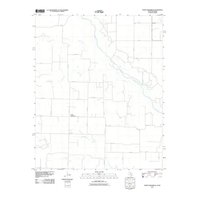
2010 Map of North Groesbeck
USGS Topo · Published 2010About this map
Red River braided channels define the northern boundary of this Hardeman County landscape, where the water marks the transition between Texas and Oklahoma. The settlement of North Groesbeck serves as a central point in a vast grid of rural roads, including FM 1166 and Ritchie Rd, which connect the isolated farmsteads of the region. To the northeast, the small community of Lincoln sits near the banks of Sandy Creek, illustrating the historical reliance on local water sources in this semi-arid terrain. The map detail highlights an intricate drainage system where Papoose Creek, Squaw Creek, and Kid Creek carve through the plains toward the main river valley. This network of seasonal creeks and named rural routes like Northam Rd and Stovall Rd provides a clear view of the land division and hydraulic geography essential to the area's ranching and agricultural history.
Find a feature on this map
33 named features on this map. Tap any name to fly to it.
Don’t see what you’re looking for? This feature index may not catch every label — zoom into the map to look around manually.
Map Details
Editions of this 2010 North Groesbeck Map
This is the sole edition of this map. No revisions or reprints were ever made.
Other maps of this area

1955 · Lawton
USGS Topo · 1:250,000

1960 · Goodlett
USGS Topo · 1:62,500

1960 · Quanah
USGS Topo · 1:62,500

1961 · Hollis
USGS Topo · 1:62,500

1971 · Duke SW
USGS Topo · 1:24,000

1975 · Hollis SE
USGS Topo · 1:24,000

1975 · Quanah NW
USGS Topo · 1:24,000
1984 · Quanah West
USGS Topo · 1:24,000
1984 · Goodlett
USGS Topo · 1:24,000
1984 · Quanah East
USGS Topo · 1:24,000