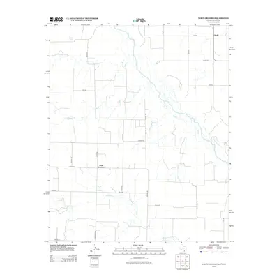
2012 Map of North Groesbeck
USGS Topo · Published 2012About this map
The Red River defines the borderlands of Hardeman County in this 2012 survey, where the braided river channel carves through the landscape between Texas and Oklahoma. The topography is dominated by numerous drainage systems, including Papoose Cr and Squaw Cr, which feed toward the main river valley. Small rural settlements like North Groesbeck and Lincoln serve as the primary human centers, connected by a network of sectional roads such as Ranch Road 1166 and Becknell Rd.
Find a feature on this map
32 named features on this map. Tap any name to fly to it.
Don’t see what you’re looking for? This feature index may not catch every label — zoom into the map to look around manually.
Map Details
Editions of this 2012 North Groesbeck Map
This is the sole edition of this map. No revisions or reprints were ever made.
Other maps of this area

1955 · Lawton
USGS Topo · 1:250,000

1960 · Goodlett
USGS Topo · 1:62,500

1960 · Quanah
USGS Topo · 1:62,500

1961 · Hollis
USGS Topo · 1:62,500

1971 · Duke SW
USGS Topo · 1:24,000

1975 · Hollis SE
USGS Topo · 1:24,000

1975 · Quanah NW
USGS Topo · 1:24,000
1984 · Quanah West
USGS Topo · 1:24,000
1984 · Goodlett
USGS Topo · 1:24,000
1984 · Quanah East
USGS Topo · 1:24,000