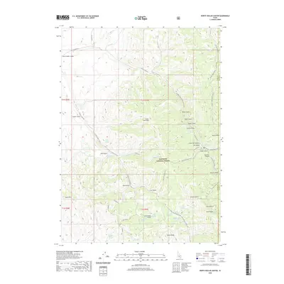
2020 Map of North Heglar Canyon
USGS Topo · Published 2020About this map
Cedar Creek Peak and the high ridges of the Sublett Range dominate this 2020 landscape within the Sawtooth National Forest. The map detail focuses on the complex drainage systems of North Heglar Canyon and South Heglar Canyon, revealing a network of seasonal routes and springs essential to high-elevation land use. Numerous family-named and descriptive water sources, including Clint Palmer Spring, Bruce Young Spring, and Moonshine Spring, are documented alongside terrain features like Eagle Point. The presence of the Mine Dump Spring suggests historical mineral exploration or activity in these canyons. Transportation is defined by forest development roads and seasonal tracks like Lake Fork Loop (Snow), illustrating the modern management of this remote portion of Cassia County where the forest boundary meets the border of Power County.
Find a feature on this map
58 named features on this map. Tap any name to fly to it.
Don’t see what you’re looking for? This feature index may not catch every label — zoom into the map to look around manually.
Map Details
Editions of this 2020 North Heglar Canyon Map
This is the sole edition of this map. No revisions or reprints were ever made.
Other maps of this area

1934 · Rockland
USGS Topo · 1:62,500

1937 · Rockland
USGS Topo · 1:62,500

1954 · Pocatello
USGS Topo · 1:250,000

1958 · Pocatello
USGS Topo · 1:250,000

1958 · Sublett
USGS Topo · 1:62,500

1959 · Yale
USGS Topo · 1:62,500

1971 · Rockland West
USGS Topo · 1:24,000

1973 · Hartley Peak
USGS Topo · 1:24,000

1973 · Sublett Troughs
USGS Topo · 1:24,000
1984 · Malad City
USGS Topo · 1:100,000