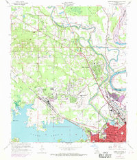
1960 Map of North Highlands
USGS Topo · Published 1969About this map
Shreveport expands northward across this mid-century landscape, where the waters of Cross Lake and Twelvemile Bayou meet a complex network of industrial and civic infrastructure. The area is defined by the heavy presence of the Kansas City Southern and Texas and Pacific railroads, which parallel the Red River and support the region's growing logistics and oil economy. Numerous educational institutions, including Northside Sch, Clark Jr High Sch, and Notre Dame High Sch, illustrate the suburban densification occurring in the North Highlands and Lake View neighborhoods.
Find a feature on this map
54 named features on this map. Tap any name to fly to it.
Don’t see what you’re looking for? This feature index may not catch every label — zoom into the map to look around manually.
Map Details
Editions of this 1960 North Highlands Map
2 editions found
Other maps of this area

1932 · Bossier SW
USGS Topo · 1:31,680

1932 · Shreveport SE
USGS Topo · 1:31,680

1932 · Bossier NW
USGS Topo · 1:31,680

1932 · Shreveport NE
USGS Topo · 1:31,680

1941 · Forbing
USGS Topo · 1:31,680

1945 · Greenwood
USGS Topo · 1:62,500

1948 · Mooringsport
USGS Topo · 1:62,500

1948 · Bossier City
USGS Topo · 1:62,500

1948 · Caspiana
USGS Topo · 1:62,500

1955 · Shreveport
USGS Topo · 1:250,000