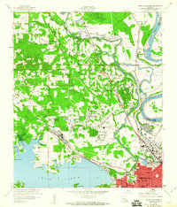
1960 Map of North Highlands
USGS Topo · Published 1960About this map
Cross Lake and the meandering path of the Red River define the landscape north of Shreveport in this 1960 revision. The transition from the dense urban grid of the city, featuring numerous educational institutions like Central Jr High Sch and Allendale Sch, to the agricultural and swampy bottomlands is sharp. Extensive water management infrastructure, including the Soda Lake Canal and various project levees, illustrates the ongoing efforts to control the flood-prone basin of Twelvemile Bayou.
Find a feature on this map
50 named features on this map. Tap any name to fly to it.
Don’t see what you’re looking for? This feature index may not catch every label — zoom into the map to look around manually.
Map Details
Editions of this 1960 North Highlands Map
2 editions found
Other maps of this area

1932 · Bossier SW
USGS Topo · 1:31,680

1932 · Shreveport SE
USGS Topo · 1:31,680

1932 · Bossier NW
USGS Topo · 1:31,680

1932 · Shreveport NE
USGS Topo · 1:31,680

1941 · Forbing
USGS Topo · 1:31,680

1945 · Greenwood
USGS Topo · 1:62,500

1948 · Mooringsport
USGS Topo · 1:62,500

1948 · Bossier City
USGS Topo · 1:62,500

1948 · Caspiana
USGS Topo · 1:62,500

1955 · Shreveport
USGS Topo · 1:250,000