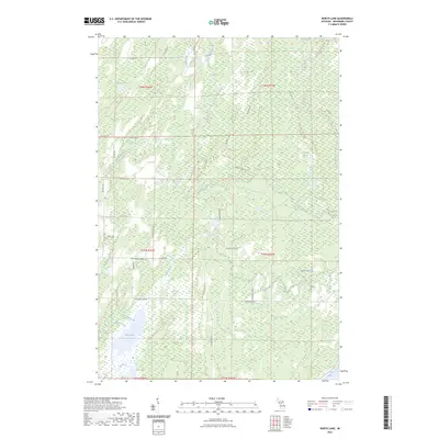
2023 Map of North Lake
USGS Topo · Published 2023About this map
North Lake and the surrounding marshlands of Menominee County dominate this modern survey, which documents a landscape defined by its intricate hydrography. The area is characterized by slow-moving water systems, including Durrow Marsh and Horseshoe Marsh, along with the southward flow of the Walton River and Cedar River. The presence of numerous family-named roads such as Wutkevicz Lane E 3, Sakovitz Rd, and Horvath Road H 1 suggests a legacy of rural land ownership and agricultural or logging access in this part of Michigan’s Upper Peninsula.
Find a feature on this map
51 named features on this map. Tap any name to fly to it.
Don’t see what you’re looking for? This feature index may not catch every label — zoom into the map to look around manually.
Map Details
Editions of this 2023 North Lake Map
This is the sole edition of this map. No revisions or reprints were ever made.
Other maps of this area

1949 · Stephenson
USGS Topo · 1:48,000

1954 · Escanaba
USGS Topo · 1:250,000

1957 · Escanaba
USGS Topo · 1:250,000

1958 · Escanaba
USGS Topo · 1:250,000

1963 · Bark River
USGS Topo · 1:62,500

1963 · Powers
USGS Topo · 1:62,500

1963 · Cedar River
USGS Topo · 1:62,500

1963 · Stephenson
USGS Topo · 1:62,500

1981 · Marinette
USGS Topo · 1:100,000

1982 · Escanaba
USGS Topo · 1:100,000
Featured Places
- Cedarville Township, MI
- Stephenson Township, MI
- Ingallston Township, MI
- Daggett Township, MI
- Menominee County, MI