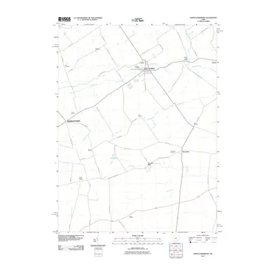
2010 Map of North Lewisburg
USGS Topo · Published 2010About this map
North Lewisburg and the nearby village of Woodstock anchor this agricultural landscape in Champaign County. The terrain is defined by the drainage networks of Big Darby Creek and Spain Creek, which are surrounded by a dense grid of rural township and county roads. Evidence of early settlement patterns is visible in the numerous small family and community burial grounds, such as Quaker Cemetery and Butcher Cemetery, that dot the countryside. Near the center of the sheet, the recreational area of Fountain Park and the waters of Brush Lake offer local landmarks amidst the fields. The map also captures the smaller hamlet of Middletown, connected by a network including Urbana Woodstock Pike and Mingo Lewisburg Rd. This survey documents the persistent rural character of the region, where the North Lewisburg Post Office remains a central point of civic identity for the surrounding farmstead community.
Find a feature on this map
61 named features on this map. Tap any name to fly to it.
Don’t see what you’re looking for? This feature index may not catch every label — zoom into the map to look around manually.
Map Details
Editions of this 2010 North Lewisburg Map
This is the sole edition of this map. No revisions or reprints were ever made.
Other maps of this area

1913 · East Liberty
USGS Topo · 1:62,500

1913 · Richwood
USGS Topo · 1:62,500

1914 · Mechanicsburg
USGS Topo · 1:62,500

1915 · Richwood
USGS Topo · 1:62,500

1915 · East Liberty
USGS Topo · 1:62,500

1916 · Mechanicsburg
USGS Topo · 1:62,500

1916 · Milford Center
USGS Topo · 1:62,500

1944 · East Liberty
USGS Topo · 1:62,500

1944 · Mechanicsburg
USGS Topo · 1:62,500

1944 · Richwood
USGS Topo · 1:62,500