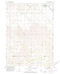
1953 Map of North Loup
USGS Topo · Published 1974About this map
North Loup serves as the primary hub in this early 1950s survey of Valley County, Nebraska. The town is situated along the Union Pacific rail line and adjacent to the North Loup Canal, reflecting the vital intersection of rail transport and irrigation infrastructure in this agricultural region. The landscape is heavily divided into townships and school districts, including Independent, Oak Creek, and Enterprise, each marked by a systematic network of rural education centers like Pleasant Hill Sch and Union Ridge Sch.
Find a feature on this map
23 named features on this map. Tap any name to fly to it.
Don’t see what you’re looking for? This feature index may not catch every label — zoom into the map to look around manually.
Map Details
Editions of this 1953 North Loup Map
2 editions found
Other maps of this area

1899 · Loup
USGS Topo · 1:125,000

1953 · Loup City NW
USGS Topo · 1:24,000

1953 · Cotesfield
USGS Topo · 1:24,000

1953 · North Loup
USGS Topo · 1:24,000

1953 · Scotia
USGS Topo · 1:24,000

1953 · Loup City SE
USGS Topo · 1:24,000

1953 · Loup City
USGS Topo · 1:24,000

1954 · Ord SE
USGS Topo · 1:24,000

1954 · Ord
USGS Topo · 1:24,000

1954 · Horace
USGS Topo · 1:24,000