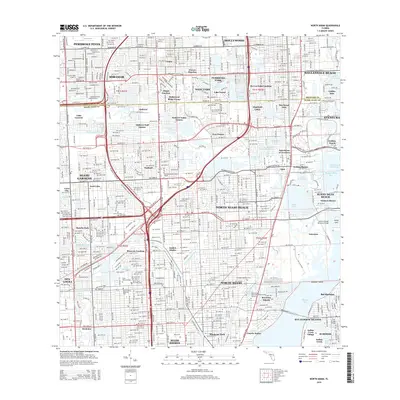
2015 Map of North Miami
USGS Topo · Published 2015About this map
Biscayne Bay and its complex network of man-made waterways anchor this depiction of the South Florida coastline in the mid-2010s. The map reveals the intricate urban geography of North Miami and its surrounding communities, where residential developments like Utopia, Carver Ranches, and Andover Lakes Estates are tightly woven between a series of drainage and transit arteries. The Snake Creek Canal and Royal Glades Canal cut through the dense grid, illustrating the engineering required to manage the region's low-lying terrain.
Find a feature on this map
95 named features on this map. Tap any name to fly to it.
Don’t see what you’re looking for? This feature index may not catch every label — zoom into the map to look around manually.
Map Details
Editions of this 2015 North Miami Map
This is the sole edition of this map. No revisions or reprints were ever made.
Other maps of this area

1947 · North Miami
USGS Topo · 1:24,000

1949 · Opalocka
USGS Topo · 1:24,000

1949 · Port Everglades
USGS Topo · 1:24,000

1949 · Fort Lauderdale South
USGS Topo · 1:24,000

1950 · Hialeah
USGS Topo · 1:24,000

1950 · Miami
USGS Topo · 1:24,000

1950 · North Miami
USGS Topo · 1:24,000

1956 · Miami
USGS Topo · 1:250,000

1956 · West Palm Beach
USGS Topo · 1:250,000

1957 · West Palm Beach
USGS Topo · 1:250,000