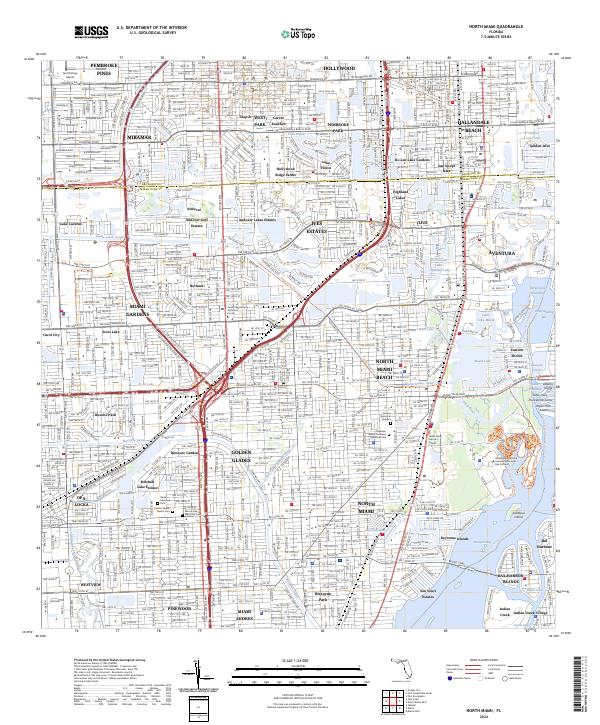
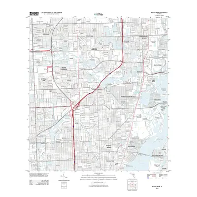
2024 Map of North Miami
USGS Topo · Published 2024About this map
Aventura and Hallandale Beach anchor this densely developed coastal corridor, where the natural hydrology of the Oleta River and Maule Lake has been extensively modified by a network of canals. The landscape is defined by its complex waterway system, including the Intracoastal Waterway and the prominent Snake Creek Canal, which facilitate movement between residential developments and the Atlantic coast. Notable large-scale institutional footprints include the Florida International University Biscayne Bay Campus and the North Perry Airport in the northwest. Local history is preserved in several prominent memorial sites such as the Greater Miami Jewish Cem and Shalom Memorial Gardens. The transit infrastructure is dominated by the Fec RR and major arteries like Sunny Isles Blvd, which connect inland communities like Miami Gardens and Golden Glades to the coastal islands and beaches.
Find a feature on this map
91 named features on this map. Tap any name to fly to it.
Don’t see what you’re looking for? This feature index may not catch every label — zoom into the map to look around manually.
Map Details
Editions of this 2024 North Miami Map
This is the sole edition of this map. No revisions or reprints were ever made.
Historical Maps of Miramar Through Time
10 maps found
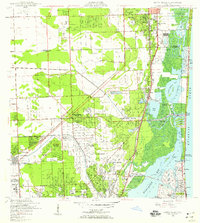
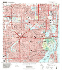
1947 North Miami
Miami-Dade County, FL

1950 North Miami
Miami-Dade County, FL
1962 North Miami
Miami-Dade County, FL
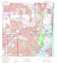
1988 North Miami
Miami-Dade County, FL
1994 North Miami
Miami-Dade County, FL
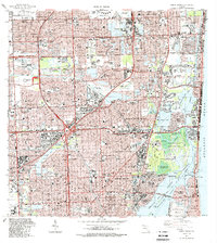
2012 North Miami
Miami-Dade County, FL

2015 North Miami
Miami-Dade County, FL
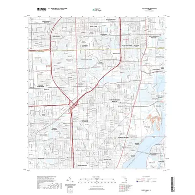
2018 North Miami
Miami-Dade County, FL
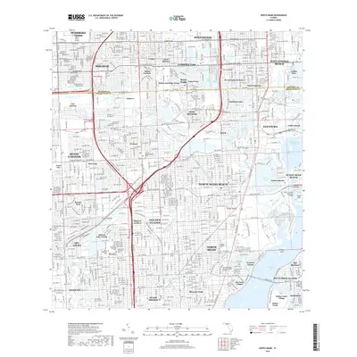
2021 North Miami
Miami-Dade County, FL
2024 North Miami
Miami-Dade County, FL