
2020 Map of North Minam Meadows
USGS Topo · Published 2020About this map
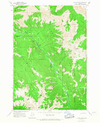
North Minam Meadows occupies a high-elevation alpine landscape within the Wallowa National Forest in northeastern Oregon. This 2020 survey details a complex network of glacial basins and peaks, where the N Minam River flows through the southwestern corner of the quadrangle. The hydrology of the area is particularly dense, featuring numerous alpine bodies such as Storm Lake, Chimney Lake, and Maxwell Lake, alongside the protected Lostine Wild and Scenic River which carves through the eastern portion of the sheet.
Find a feature on this map
56 named features on this map. Tap any name to fly to it.
Don’t see what you’re looking for? This feature index may not catch every label — zoom into the map to look around manually.
Map Details
Editions of this 2020 North Minam Meadows Map
This is the sole edition of this map. No revisions or reprints were ever made.
Other maps of this area

1906 · Telocaset
USGS Topo · 1:125,000

1954 · Eagle Cap
USGS Topo · 1:62,500

1955 · Grangeville
USGS Topo · 1:250,000

1957 · Enterprise
USGS Topo · 1:62,500

1959 · Grangeville
USGS Topo · 1:250,000

1965 · China Cap
USGS Topo · 1:24,000

1965 · Fox Point
USGS Topo · 1:24,000
1966 · Jim White Ridge
USGS Topo · 1:24,000

1986 · Enterprise
USGS Topo · 1:100,000

1990 · Lostine
USGS Topo · 1:24,000