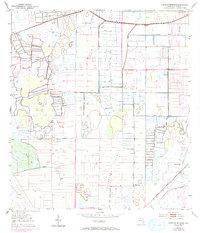
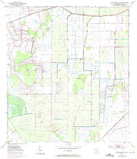
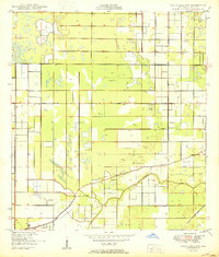
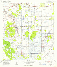
1953 Map of North Of Bluefield
USGS Topo · Published 1993About this map
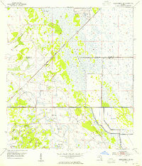
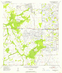
Allapattah Flats dominates this mid-century landscape of St. Lucie County, revealing a region defined by extensive drainage and water management projects. The map documents an intricate system of engineering, where numerous instances of Spoil Bank, Levee, and the Rim Ditch have fundamentally reshaped the terrain for agricultural or developmental use. These man-made features intersect with natural hydrology, such as the winding course of Cypress Creek, illustrating the transition from wetlands to a controlled rural environment.
Find a feature on this map
10 named features on this map. Tap any name to fly to it.
Don’t see what you’re looking for? This feature index may not catch every label — zoom into the map to look around manually.
Map Details
Editions of this 1953 North Of Bluefield Map
3 editions found
Other maps of this area

1949 · Fort Pierce NW
USGS Topo · 1:24,000
1950 · Fort Pierce NW
USGS Topo · 1:24,000
1953 · Okeechobee 1 SE
USGS Topo · 1:24,000
1953 · Okeechobee 4 NE
USGS Topo · 1:24,000
1953 · Okeechobee 4 NW
USGS Topo · 1:24,000
1953 · Okeechobee 1 SW
USGS Topo · 1:24,000

1953 · Indian Town NW
USGS Topo · 1:24,000
1953 · Okeechobee 1 NE
USGS Topo · 1:24,000
1953 · Okeechobee 1 NW
USGS Topo · 1:24,000
1953 · Fort Pierce SW
USGS Topo · 1:24,000