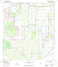
1953 Map of Okeechobee 1 SE
USGS Topo · Published 1971About this map
Allapattah Flats dominates this portion of St. Lucie Co., where a complex network of man-made water management features intersects with the native Florida landscape. The terrain is defined by a rigorous grid of canals and embankments, including numerous Spoil Banks and an extensive Levee system that directs water across the low-lying region. This 1950s survey, with later photorevisions, captures the industrialization of the landscape through the presence of several Flowing Wells and a Gaging Sta, likely serving the agricultural or drainage needs of the period.
Find a feature on this map
10 named features on this map. Tap any name to fly to it.
Don’t see what you’re looking for? This feature index may not catch every label — zoom into the map to look around manually.
Map Details
Editions of this 1953 Okeechobee 1 SE Map
3 editions found
Other maps of this area

1949 · Fort Pierce NW
USGS Topo · 1:24,000

1950 · Fort Pierce NW
USGS Topo · 1:24,000

1953 · Okeechobee 1 SE
USGS Topo · 1:24,000

1953 · Okeechobee 4 NE
USGS Topo · 1:24,000

1953 · Okeechobee 4 NW
USGS Topo · 1:24,000

1953 · Okeechobee 1 SW
USGS Topo · 1:24,000

1953 · Indian Town NW
USGS Topo · 1:24,000

1953 · Okeechobee 1 NE
USGS Topo · 1:24,000

1953 · Okeechobee 1 NW
USGS Topo · 1:24,000

1953 · Fort Pierce SW
USGS Topo · 1:24,000