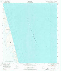
1952 Map of North Of Port Isabel NW
USGS Topo · Published 1974About this map
Padre Island is the central focus of this 1950s coastal survey, depicting the dynamic barrier island landscape along the South Texas coast. The map captures a wilderness of Shifting Sand Dunes, some reaching elevations up to 23 feet, and extensive Sand Flats that transition into the shallow waters of the Laguna Madre to the west. This period of mapping precedes the major development of the region, showing the pristine state of landmarks like Negro and Camwill near the Willacy Co Cameron Co Approximate Bdy. The expansive reach of the Gulf of Mexico dominates the eastern half of the sheet, with hydrographic soundings from 1939 providing a detailed look at the offshore depths before mid-century changes. The lack of cultural features or roads emphasizes the isolation of this stretch of the Texas coastline during the early post-war era.
Find a feature on this map
11 named features on this map. Tap any name to fly to it.
Don’t see what you’re looking for? This feature index may not catch every label — zoom into the map to look around manually.
Map Details
Editions of this 1952 North Of Port Isabel NW Map
2 editions found
Other maps of this area

1929 · Buena Vista
USGS Topo · 1:24,000

1930 · Padre Island No. 2
USGS Topo · 1:24,000

1935 · Padre Island NO. 2
USGS Topo · 1:31,680

1935 · Buena Vista
USGS Topo · 1:31,680

1952 · Green Island
USGS Topo · 1:24,000
1952 · North Of Port Isabel NW
USGS Topo · 1:24,000

1952 · South of Potrero Lopeno SE
USGS Topo · 1:24,000

1952 · South of Potrero Lopeno
USGS Topo · 1:62,500

1953 · Brownsville
USGS Topo · 1:250,000
1954 · Three Islands
USGS Topo · 1:24,000