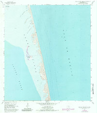
1955 Map of North Of Port Isabel SW
USGS Topo · Published 1984About this map
Padre Island stretches along the South Texas coast in this mid-century survey, capturing a wild barrier landscape defined by shifting sand dunes and vast stretches of sand. Positioned between the Gulf of Mexico and the shallow waters of the Laguna Madre, the map reveals a coastline in flux, shaped by wind and tide rather than urban development.
Find a feature on this map
10 named features on this map. Tap any name to fly to it.
Don’t see what you’re looking for? This feature index may not catch every label — zoom into the map to look around manually.
Map Details
Editions of this 1955 North Of Port Isabel SW Map
3 editions found
Other maps of this area

1929 · La Coma
USGS Topo · 1:24,000

1929 · Buena Vista
USGS Topo · 1:24,000

1930 · Padre Island No. 1
USGS Topo · 1:24,000

1930 · Padre Island No. 2
USGS Topo · 1:24,000

1934 · La Coma
USGS Topo · 1:31,680

1935 · Padre Island No 1
USGS Topo · 1:31,680

1935 · Padre Island NO. 2
USGS Topo · 1:31,680

1935 · Buena Vista
USGS Topo · 1:31,680

1952 · Green Island
USGS Topo · 1:24,000
1952 · North Of Port Isabel NW
USGS Topo · 1:24,000