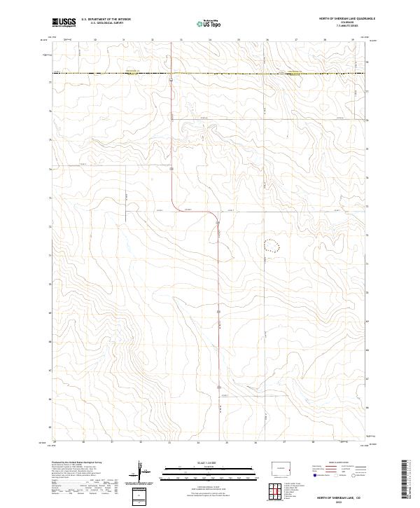
2022 Map of North of Sheridan Lake
USGS Topo · Published 2022About this map
Cheyenne and Kiowa counties meet along a high, arid plateau in this 2022 U.S. Department of the Interior survey of eastern Colorado. The landscape is defined by a strictly rectilinear grid of county roads and section lines, typical of the Great Plains' agricultural and ranching development. Arteries like Co Rd 65 and Co Rd 66 bisect the open country, providing access across the expansive townships of t17s r44w and t16s r43w. The topography is characterized by subtle drainage patterns and ephemeral water features, such as those near Co Rd 67, which reveal the natural flow of the land beneath the human-imposed geometry of the range and township system.
Find a feature on this map
20 named features on this map. Tap any name to fly to it.
Don’t see what you’re looking for? This feature index may not catch every label — zoom into the map to look around manually.
Map Details
Editions of this 2022 North of Sheridan Lake Map
This is the sole edition of this map. No revisions or reprints were ever made.
Other maps of this area

1890 · Granada
USGS Topo · 1:125,000

1892 · Cheyenne Wells
USGS Topo · 1:125,000

1892 · Granada
USGS Topo · 1:125,000

1894 · Cheyenne Wells
USGS Topo · 1:125,000

1894 · Granada
USGS Topo · 1:125,000

1954 · Lamar
USGS Topo · 1:250,000

1958 · Lamar
USGS Topo · 1:250,000

1968 · Stuart
USGS Topo · 1:24,000

1968 · Sheridan Lake
USGS Topo · 1:24,000
1968 · Brandon
USGS Topo · 1:24,000