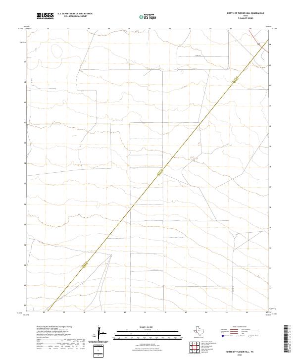
2022 Map of North of Tucker Hill
USGS Topo · Published 2022About this map
The high desert boundary between Reeves Co and Pecos Co defines this quiet West Texas landscape, where modern road networks follow a distinct orthogonal grid across the arid flats. This 2022 survey captures the area north of Tucker Hill, dominated by the long diagonal line of the county division. Infrastructure is minimal, consisting of rural connectors like Co Rd 111 and Co Rd 108 that navigate the open country. The placement of Mendel Rd in the southern portion of the sheet suggests a landscape largely shaped by ranching or resource management, where few permanent structures exist but legal and property boundaries remain precisely surveyed.
Find a feature on this map
4 named features on this map. Tap any name to fly to it.
Don’t see what you’re looking for? This feature index may not catch every label — zoom into the map to look around manually.
Map Details
Editions of this 2022 North of Tucker Hill Map
This is the sole edition of this map. No revisions or reprints were ever made.
Other maps of this area

1929 · Hovey
USGS Topo · 1:125,000

1931 · Barstow
USGS Topo · 1:125,000

1954 · Pecos
USGS Topo · 1:250,000

1954 · Fort Stockton
USGS Topo · 1:250,000

1957 · Pecos
USGS Topo · 1:250,000

1958 · Fort Stockton
USGS Topo · 1:250,000

1970 · Tucker Hill
USGS Topo · 1:24,000
1970 · Barstow 3 SW
USGS Topo · 1:24,000

1970 · Belding NW
USGS Topo · 1:24,000
1970 · Barstow 3 SE
USGS Topo · 1:24,000