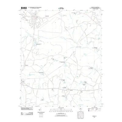
2011 Map of North
USGS Topo · Published 2011About this map
North Air Force Auxiliary Field anchors the northeastern landscape of this Orangeburg County region, serving as a prominent military installation just outside the town of North. This era shows a community defined by its waterways and small rural settlements, including Livingston, Neeses, and Pine Hill. The North Fork Edisto River winds through the center of the sheet, fed by numerous tributaries such as Turkey Branch and Bull Swamp Creek. The landscape is heavily dotted with named water features and private impoundments like Hutto Millpond, Bolen Pond, and the Davis Ponds, illustrating the region's managed hydrography. For genealogists, the map identifies several burial grounds including Saint James Cemetery, Hickory Hill Cemetery, and Double Branch Cemetery, providing specific geographic anchors for local family history research within these rural South Carolina townships.
Find a feature on this map
128 named features on this map. Tap any name to fly to it.
Don’t see what you’re looking for? This feature index may not catch every label — zoom into the map to look around manually.
Map Details
Editions of this 2011 North Map
This is the sole edition of this map. No revisions or reprints were ever made.
Other maps of this area

1919 · Bamberg
USGS Topo · 1:48,000

1920 · Bamberg
USGS Topo · 1:62,500

1920 · Orangeburg
USGS Topo · 1:48,000

1921 · Orangeburg
USGS Topo · 1:62,500

1943 · Bamberg
USGS Topo · 1:62,500

1943 · Orangeburg
USGS Topo · 1:125,000

1943 · Orangeburg
USGS Topo · 1:62,500

1946 · Woodford
USGS Topo · 1:62,500

1946 · St. Matthews
USGS Topo · 1:62,500

1954 · Augusta
USGS Topo · 1:250,000