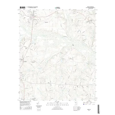
2017 Map of North
USGS Topo · Published 2017About this map
The town of North serves as the focal point for this area of Orangeburg County, where the landscape is defined by the wetlands of the N Fork Edisto River and its numerous tributaries. A significant portion of the northern terrain is occupied by the North Air Force Auxiliary Field, an expansive military facility established decades prior to this survey. The map reveals a high density of rural religious and family sites, such as the Amaker Jeffcoat - Harley Family Cem and Hebron Methodist Church South Cem, indicating deep-seated generational roots in the region. Hydrology plays a central role in the local geography, with landmarks like Hutto Millpond and Slab Landing Bridge marking historic points of crossing and resource management along the winding Bull Swamp Cr. Further south, the settlements of Livingston and Neeses anchor the agricultural and residential corridors.
Find a feature on this map
138 named features on this map. Tap any name to fly to it.
Don’t see what you’re looking for? This feature index may not catch every label — zoom into the map to look around manually.
Map Details
Editions of this 2017 North Map
This is the sole edition of this map. No revisions or reprints were ever made.
Other maps of this area

1919 · Bamberg
USGS Topo · 1:48,000

1920 · Bamberg
USGS Topo · 1:62,500

1920 · Orangeburg
USGS Topo · 1:48,000

1921 · Orangeburg
USGS Topo · 1:62,500

1943 · Bamberg
USGS Topo · 1:62,500

1943 · Orangeburg
USGS Topo · 1:125,000

1943 · Orangeburg
USGS Topo · 1:62,500

1946 · Woodford
USGS Topo · 1:62,500

1946 · St. Matthews
USGS Topo · 1:62,500

1954 · Augusta
USGS Topo · 1:250,000