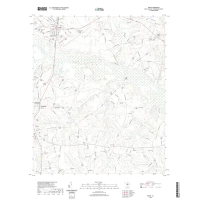
2020 Map of North
USGS Topo · Published 2020About this map
The N Fork Edisto River meanders through this portion of Orangeburg County, creating a landscape defined by expansive wetlands and numerous private impoundments such as Hutto Millpond and Knots Pond. The settlement of North serves as a local hub, adjacent to the sprawling North Air Force Auxiliary Airfield. Smaller communities like Livingston and Neeses are connected by a network of rural roads that pass by deeply rooted local institutions. The map is particularly rich for genealogical research, documenting numerous family and congregational burial grounds including the Amaker - Jeffcoat - Harley Family Cem and Shady Grove Cem. From the Slab Landing Bridge to the banks of Bull Swamp Cr, the topography reveals a transition from managed timber and agricultural lands to the complex drainage basins of the Roberts Swamp and Great Br.
Find a feature on this map
121 named features on this map. Tap any name to fly to it.
Don’t see what you’re looking for? This feature index may not catch every label — zoom into the map to look around manually.
Map Details
Editions of this 2020 North Map
This is the sole edition of this map. No revisions or reprints were ever made.
Other maps of this area

1919 · Bamberg
USGS Topo · 1:48,000

1920 · Bamberg
USGS Topo · 1:62,500

1920 · Orangeburg
USGS Topo · 1:48,000

1921 · Orangeburg
USGS Topo · 1:62,500

1943 · Bamberg
USGS Topo · 1:62,500

1943 · Orangeburg
USGS Topo · 1:125,000

1943 · Orangeburg
USGS Topo · 1:62,500

1946 · Woodford
USGS Topo · 1:62,500

1946 · St. Matthews
USGS Topo · 1:62,500

1954 · Augusta
USGS Topo · 1:250,000