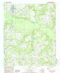
1988 Map of North
USGS Topo · Published 1988About this map
The North Air Force Auxiliary Field dominates the northern landscape of this Orangeburg County region, situated just east of the town of North. This part of South Carolina is defined by the winding course of the North Fork Edisto River, which creates a broad floodplain flanked by numerous tributaries and family-named landmarks. The map documents a rural economy historically tied to water management, as evidenced by Hutto Millpond and Culler Millpond. Further south, the settlements of Livingston and Neeses provide clear reference points for genealogists tracking family land along the banks of Big Beaver Creek or the wetlands of Roberts Swamp. The intricate drainage patterns, including Bull Swamp Creek and Turkey Branch, reveal the natural challenges and opportunities faced by local residents in the late 20th century.
Find a feature on this map
24 named features on this map. Tap any name to fly to it.
Don’t see what you’re looking for? This feature index may not catch every label — zoom into the map to look around manually.
Map Details
Editions of this 1988 North Map
This is the sole edition of this map. No revisions or reprints were ever made.
Other maps of this area

1919 · Bamberg
USGS Topo · 1:48,000

1920 · Bamberg
USGS Topo · 1:62,500

1920 · Orangeburg
USGS Topo · 1:48,000

1921 · Orangeburg
USGS Topo · 1:62,500

1943 · Bamberg
USGS Topo · 1:62,500

1943 · Orangeburg
USGS Topo · 1:125,000

1943 · Orangeburg
USGS Topo · 1:62,500

1946 · Woodford
USGS Topo · 1:62,500

1946 · St. Matthews
USGS Topo · 1:62,500

1954 · Augusta
USGS Topo · 1:250,000