
1970 Map of North Platte West
USGS Topo · Published 1973About this map
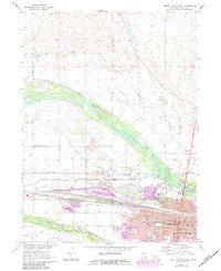
The confluence of Nebraska's major waterways is captured in this 1970s record, showing the North Platte River and South Platte River converging as they approach North Platte. The city’s expansion northward is evident, with the urban grid pushing toward the riverbanks where landmark institutions like the North Platte Cem and North Platte Country Club were established. Of particular interest to local historians is the Buffalo Bill Ranch State Park, preserving the legacy of William F. Cody near the Union Pacific rail lines that fueled the town's growth as a major transportation hub. The landscape is a mix of heavy industrial presence, such as numerous Gravel Pits, and civic infrastructure including Memorial High Sch and St Patricks Cath Ch, reflecting a community deeply tied to both its river environment and its railroad heritage.
Find a feature on this map
48 named features on this map. Tap any name to fly to it.
Don’t see what you’re looking for? This feature index may not catch every label — zoom into the map to look around manually.
Map Details
Editions of this 1970 North Platte West Map
2 editions found
Other maps of this area

1899 · North Platte
USGS Topo · 1:125,000

1902 · North Platte
USGS Topo · 1:125,000

1954 · North Platte
USGS Topo · 1:250,000

1956 · North Platte
USGS Topo · 1:250,000

1957 · North Platte
USGS Topo · 1:250,000

1967 · North Platte
USGS Topo · 1:250,000

1970 · North Platte East
USGS Topo · 1:24,000
1970 · North Platte SW
USGS Topo · 1:24,000
1970 · Hershey East
USGS Topo · 1:24,000
1970 · Maxwell SW
USGS Topo · 1:24,000
Featured Places
- North Platte, NE
- Green Acres Trailer Court, NE
- Mobile Manor, North Platte
- Village Square, North Platte
- Key Estates, North Platte