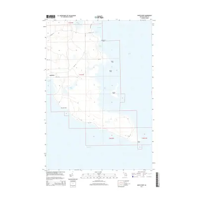
2014 Map of North Point
USGS Topo · Published 2014About this map
Lake Huron defines the rugged eastern edge of Alpena, where a complex network of bays and coves carves into the Michigan shoreline. The landscape is characterized by its dramatic hydrology, featuring larger bodies like Thunder Bay and Misery Bay alongside smaller, more secluded features such as El Cajon Bay and Roberts Cove. Inland, the terrain is dotted with freshwater bodies including Elbow Lake and Grass Lake, which are connected by a light network of local routes like N Point Rd and Indian Rd.
Find a feature on this map
26 named features on this map. Tap any name to fly to it.
Don’t see what you’re looking for? This feature index may not catch every label — zoom into the map to look around manually.
Map Details
Editions of this 2014 North Point Map
This is the sole edition of this map. No revisions or reprints were ever made.
Other maps of this area

1954 · Tawas City
USGS Topo · 1:250,000

1954 · Alpena
USGS Topo · 1:250,000

1957 · Alpena
USGS Topo · 1:250,000

1958 · Alpena
USGS Topo · 1:250,000

1958 · Tawas City
USGS Topo · 1:250,000

1969 · Alpena
USGS Topo · 1:250,000

1971 · Alpena
USGS Topo · 1:24,000
1971 · Thunder Bay Island
USGS Topo · 1:24,000

1971 · Middle Island
USGS Topo · 1:24,000

1971 · North Point
USGS Topo · 1:24,000