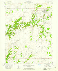
1958 Map of North Salem
USGS Topo · Published 1959About this map
North Salem sits at the heart of this central Indiana landscape, where the headwaters of the Middle Fork Eel River and West Fork Eel River begin their winding courses. The region is defined by a traditional agricultural layout, with small crossroads settlements like New Maysville and Groveland serving as local anchors. The transit network reveals a layering of eras, from the established line of the Baltimore and Ohio railroad passing through Barnard to the modern stretch of the Memorial Highway in the south. Land use is largely rural, marked by family and community landmarks such as Mt Olivet Ch and the Fairview Cem. The deeply incised path of Big Walnut Creek provides a sharp contrast to the surrounding upland plains of Clark and Jackson townships, illustrating the area's natural drainage before reaching the larger river systems.
Find a feature on this map
28 named features on this map. Tap any name to fly to it.
Don’t see what you’re looking for? This feature index may not catch every label — zoom into the map to look around manually.
Map Details
Editions of this 1958 North Salem Map
Other maps of this area

1953 · Clayton
USGS Topo · 1:24,000

1953 · Lizton
USGS Topo · 1:24,000

1953 · Danville
USGS Topo · 1:24,000

1953 · Indianapolis
USGS Topo · 1:250,000

1956 · Indianapolis
USGS Topo · 1:250,000

1957 · Indianapolis
USGS Topo · 1:250,000

1957 · New Ross
USGS Topo · 1:24,000

1958 · Roachdale
USGS Topo · 1:24,000

1958 · Ladoga
USGS Topo · 1:24,000

1958 · Coatesville
USGS Topo · 1:24,000