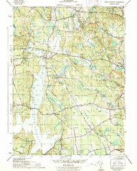
1943 Map of North Scituate
USGS Topo · Published 1943About this map
The vast Scituate Reservoir dominates this wartime landscape, having fundamentally reshaped the hydrology of central Providence County. This engineering marvel is supported by a large Filtration Plant and Kent Dam at its southern reach, marking the transition from a network of smaller mill ponds to a massive municipal water system. The map captures established settlements like North Scituate and Greenville alongside historical landmarks such as the Scituate Town House.
Find a feature on this map
66 named features on this map. Tap any name to fly to it.
Don’t see what you’re looking for? This feature index may not catch every label — zoom into the map to look around manually.
Map Details
Editions of this 1943 North Scituate Map
4 editions found
Other maps of this area

1887 · Providence
USGS Topo · 1:62,500

1889 · Providence
USGS Topo · 1:62,500

1889 · Burrillville
USGS Topo · 1:62,500

1890 · Narragansett Bay
USGS Topo · 1:62,500

1890 · Kent
USGS Topo · 1:62,500

1892 · Narragansett Bay
USGS Topo · 1:62,500

1894 · Burrillville
USGS Topo · 1:62,500

1894 · Kent
USGS Topo · 1:62,500

1894 · Providence
USGS Topo · 1:62,500

1915 · Burrillville
USGS Topo · 1:62,500