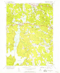
1955 Map of North Scituate
USGS Topo · Published 1958About this map
The Scituate Reservoir dominates this Rhode Island landscape, reflecting the massive mid-century water infrastructure required for the Providence region. The reservoir's construction necessitated significant changes to the local geography, visible here in features like the Ashland Causeway and the Gainer Memorial Dam. Surrounding the water, the rural character of northern Rhode Island is preserved through a network of small villages and historical sites, including North Scituate and Greenville.
Find a feature on this map
120 named features on this map. Tap any name to fly to it.
Don’t see what you’re looking for? This feature index may not catch every label — zoom into the map to look around manually.
Map Details
Editions of this 1955 North Scituate Map
3 editions found
Other maps of this area

1887 · Providence
USGS Topo · 1:62,500

1889 · Providence
USGS Topo · 1:62,500

1889 · Burrillville
USGS Topo · 1:62,500

1890 · Narragansett Bay
USGS Topo · 1:62,500

1890 · Kent
USGS Topo · 1:62,500

1892 · Narragansett Bay
USGS Topo · 1:62,500

1894 · Burrillville
USGS Topo · 1:62,500

1894 · Kent
USGS Topo · 1:62,500

1894 · Providence
USGS Topo · 1:62,500

1915 · Burrillville
USGS Topo · 1:62,500