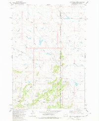
1980 Map of North Slick Creek
USGS Topo · Published 1980About this map
Custer National Forest anchors the southern landscape of this 1980 survey, where the drainages of the Slick Creek system define the local topography. This borderland region between Montana and South Dakota reflects a specialized ranching and resource economy, centered around water management and livestock. Several named water sources, such as Pendleton Well and Plum Creek Well, suggest the importance of groundwater for survival in this arid terrain.
Find a feature on this map
21 named features on this map. Tap any name to fly to it.
Don’t see what you’re looking for? This feature index may not catch every label — zoom into the map to look around manually.
Map Details
Editions of this 1980 North Slick Creek Map
2 editions found
Other maps of this area

1935 · Buffalo
USGS Topo · 1:125,000

1954 · Lemmon
USGS Topo · 1:250,000

1954 · Ekalaka
USGS Topo · 1:250,000

1956 · Ekalaka
USGS Topo · 1:250,000

1957 · Lemmon
USGS Topo · 1:250,000

1958 · Ekalaka
USGS Topo · 1:250,000

1965 · Ekalaka
USGS Topo · 1:250,000

1974 · Caroline Butte
USGS Topo · 1:24,000
1977 · Scott Creek
USGS Topo · 1:24,000
1977 · Camp Crook
USGS Topo · 1:24,000