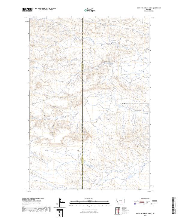
2024 Map of North Telegraph Creek
USGS Topo · Published 2024About this map
The county boundary between Yellowstone County and Big Horn County bisects this landscape of drainage basins and transport routes in southern Montana. The watershed is defined by the winding paths of North Telegraph Creek, Telegraph Creek, and Fly Creek, which carve through the high plains terrain. Local transportation history is marked by the presence of Old US Hwy 87 and Hardin Rd, providing a look at the established road network that links these rural reaches. The map highlights the intersection of Township and Range lines including t1s r29e, t1s r30e, t2s r29e, and t2s r30e, illustrating the precise Public Land Survey System grid that governs this area of the Big Horn region.
Find a feature on this map
10 named features on this map. Tap any name to fly to it.
Don’t see what you’re looking for? This feature index may not catch every label — zoom into the map to look around manually.
Map Details
Editions of this 2024 North Telegraph Creek Map
This is the sole edition of this map. No revisions or reprints were ever made.
Other maps of this area

1893 · Huntley
USGS Topo · 1:125,000

1894 · Fort Custer
USGS Topo · 1:125,000

1954 · Billings
USGS Topo · 1:250,000

1954 · Hardin
USGS Topo · 1:250,000

1957 · Hardin
USGS Topo · 1:250,000

1957 · Billings
USGS Topo · 1:250,000

1958 · Billings
USGS Topo · 1:250,000

1958 · Hardin
USGS Topo · 1:250,000
1969 · Rowley NW
USGS Topo · 1:24,000
1969 · Woody Mountain NW
USGS Topo · 1:24,000