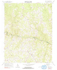
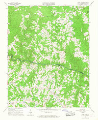
1966 Map of North View
USGS Topo · Published 1991About this map
The Meherrin River serves as the primary geographical divider in this mid-1960s landscape, marking the boundary between Lunenburg Co and Mecklenburg Co. The rural character of the region is defined by a network of small creeks—including Crooked Creek, Mason Creek, and Miles Creek—that feed into the river valley. Settlement is concentrated in small, crossroads communities such as North View, Bagleys Mills, and Gary.
Find a feature on this map
34 named features on this map. Tap any name to fly to it.
Don’t see what you’re looking for? This feature index may not catch every label — zoom into the map to look around manually.
Map Details
Editions of this 1966 North View Map
4 editions found
Other maps of this area

1953 · Greensboro
USGS Topo · 1:250,000

1954 · Greensboro
USGS Topo · 1:250,000

1955 · Chase City
USGS Topo · 1:62,500

1955 · Kenbridge
USGS Topo · 1:62,500

1955 · Boydton
USGS Topo · 1:62,500

1962 · Greensboro
USGS Topo · 1:250,000

1966 · Greensboro
USGS Topo · 1:250,000
1966 · Wightman
USGS Topo · 1:24,000
1966 · North View
USGS Topo · 1:24,000
1966 · Lunenburg
USGS Topo · 1:24,000