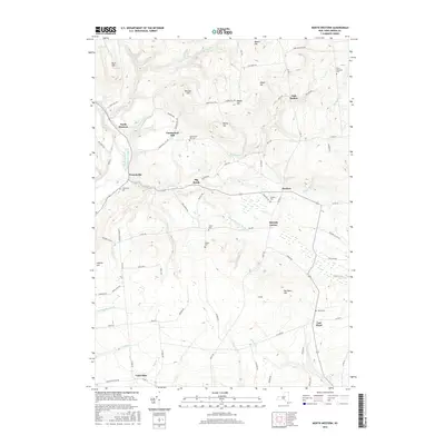
2016 Map of North Western
USGS Topo · Published 2016About this map
The Mohawk River Black River Canal forms a central spine through this Oneida County landscape, tracing a historic transportation corridor past the settlement of North Western. This 2016 survey captures a highland region defined by prominent peaks like Boody Hill and Meszler Hill, which rise above a network of waterways including Beaver Meadow Brook and Wells Cr. The map is particularly valuable for genealogical research, documenting numerous family and community burial grounds such as Ward Cem, Nisbet Cem, and Frenchville Cem. Small hamlets and crossroads like East Floyd, Frenchville, and Merrick Corner anchor the rural road system, illustrating a long-standing pattern of dispersed agricultural settlement. The topography is further punctuated by distinctive landmarks such as Maple Mtn and Pen Bonc Hill, which overlook the complex drainage basins of Gifford Cr and Gulf Cr.
Find a feature on this map
87 named features on this map. Tap any name to fly to it.
Don’t see what you’re looking for? This feature index may not catch every label — zoom into the map to look around manually.
Map Details
Editions of this 2016 North Western Map
This is the sole edition of this map. No revisions or reprints were ever made.
Other maps of this area

1895 · Oriskany
USGS Topo · 1:62,500

1897 · Remsen
USGS Topo · 1:62,500

1898 · Utica
USGS Topo · 1:62,500

1898 · Oriskany
USGS Topo · 1:62,500

1900 · Utica
USGS Topo · 1:62,500

1900 · Remsen
USGS Topo · 1:62,500

1904 · Boonville
USGS Topo · 1:62,500
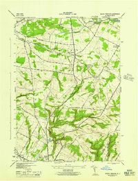
1945 · South Trenton
USGS Topo · 1:31,680

1945 · Boonville
USGS Topo · 1:24,000

1945 · Forestport
USGS Topo · 1:24,000