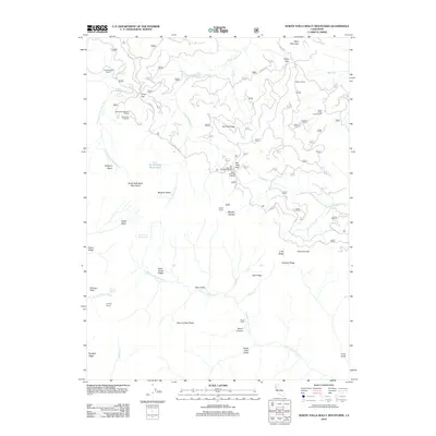
2012 Map of North Yolla Bolly Mountains
USGS Topo · Published 2012About this map
North Yolla Bolly Lake sits at the heart of this high-elevation wilderness in Tehama County, where the headwaters of several major drainages begin their descent. The terrain is defined by sharp ridges and deep canyons, including the complex water systems of S Fork Beegum Cr and the S Fork Cottonwood Cr. This landscape is marked by a network of seasonal camps and remote landmarks like Grasshoppers Camp, Barker Camp, and Murphy Glades, which suggest a long history of cattle ranging and back-country recreation. High points such as Tedoc Mountain and Chicago Rock dominate the skyline, while numerous gaps and basins like Rat Trap Gap and Pettijohn Basin provide the few navigable passages through the steep topography. A sophisticated system of Forest Service routes, including Forest Rte 35 and Tedoc Rd, connects isolated outposts like Weston Ranch to the more developed Wells Creek Campground.
Find a feature on this map
70 named features on this map. Tap any name to fly to it.
Don’t see what you’re looking for? This feature index may not catch every label — zoom into the map to look around manually.
Map Details
Editions of this 2012 North Yolla Bolly Mountains Map
This is the sole edition of this map. No revisions or reprints were ever made.
Other maps of this area

1890 · Red Bluff
USGS Topo · 1:250,000

1894 · Red Bluff
USGS Topo · 1:250,000

1931 · Hoaglin
USGS Topo · 1:96,000

1935 · Hoaglin
USGS Topo · 1:125,000

1951 · Chanchelulla Peak
USGS Topo · 1:62,500

1953 · Blackrock Mtn
USGS Topo · 1:62,500

1954 · Dubakella Mtn
USGS Topo · 1:62,500

1954 · Blackrock Mtn
USGS Topo · 1:62,500

1954 · Yolla Bolly
USGS Topo · 1:62,500

1958 · Redding
USGS Topo · 1:250,000