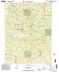
1998 Map of North Yolla Bolly Mountains
USGS Topo · Published 2003About this map
Weston Ranch and Baker Camp represent the few pockets of human habitation and seasonal infrastructure within this high-elevation landscape. The terrain is defined by the sharp drainage systems of Beegum Creek and the East Fork South Fork Cottonwood Creek, showing a network of remote outposts set against the steep ridgelines of the North Yolla Bolly Mountains. Surveyed in the late 1990s, this map provides a detailed look at the interface between private holdings and federal land management. Researchers can trace the limited road and trail access that connected these isolated camps to the larger Tehama County region during a period of modern forest administration.
Find a feature on this map
4 named features on this map. Tap any name to fly to it.
Don’t see what you’re looking for? This feature index may not catch every label — zoom into the map to look around manually.
Map Details
Editions of this 1998 North Yolla Bolly Mountains Map
This is the sole edition of this map. No revisions or reprints were ever made.
Other maps of this area

1890 · Red Bluff
USGS Topo · 1:250,000

1894 · Red Bluff
USGS Topo · 1:250,000

1931 · Hoaglin
USGS Topo · 1:96,000

1935 · Hoaglin
USGS Topo · 1:125,000

1951 · Chanchelulla Peak
USGS Topo · 1:62,500

1953 · Blackrock Mtn
USGS Topo · 1:62,500

1954 · Dubakella Mtn
USGS Topo · 1:62,500

1954 · Blackrock Mtn
USGS Topo · 1:62,500

1954 · Yolla Bolly
USGS Topo · 1:62,500

1958 · Redding
USGS Topo · 1:250,000